DESCRIPTION
FMI, with 80% borehole coverage in 8-in boreholes and 0.2-in image resolution in the vertical and azimuthal directions, imaging with the FMI microimager is the preferred approach for determining net pay in laminated sediments of fluvial, turbidite and carbonate depositional environments.
Knowledge of sedimentary features is important for determining reservoir geometry and petrophysical reservoir parameters. Image details can be discerned down to 50 um and complement coring and sampling data, especially for describing intervals that were not cored.
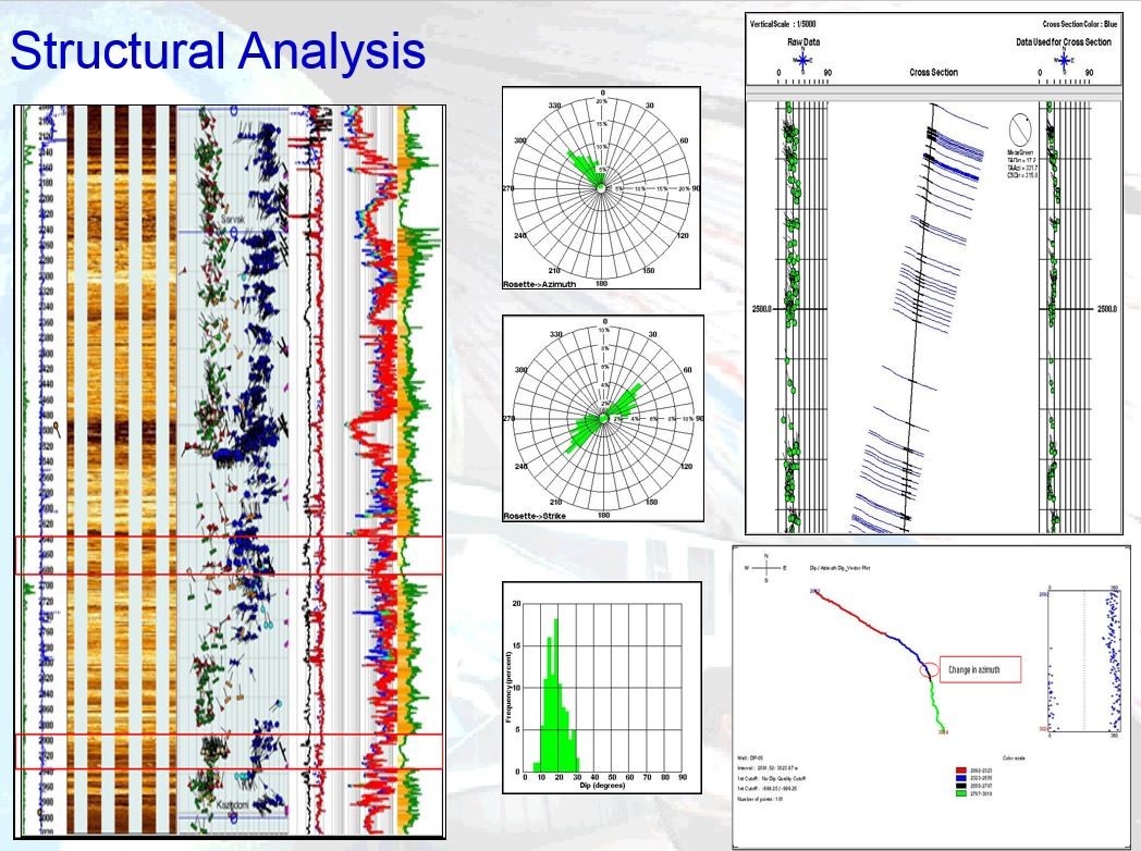
Interpretation that combines images and derived sedimentary dip data from the FMI microimager gives you greater insight into structures—both natural and drilling induced—that are present in the reservoir.
Beyond the wellsite answers listed for basic structural and sedimentary understanding, integrated interpretation employs advanced workflows, the multidisciplinary expertise of our interpretation geoscientists and engineers working on the application of software to maximize the value of client logging data. The result is the fullest possible understanding of structural and stratigraphic features, including complex faults, folds, porosity distributions, and net sand counts.